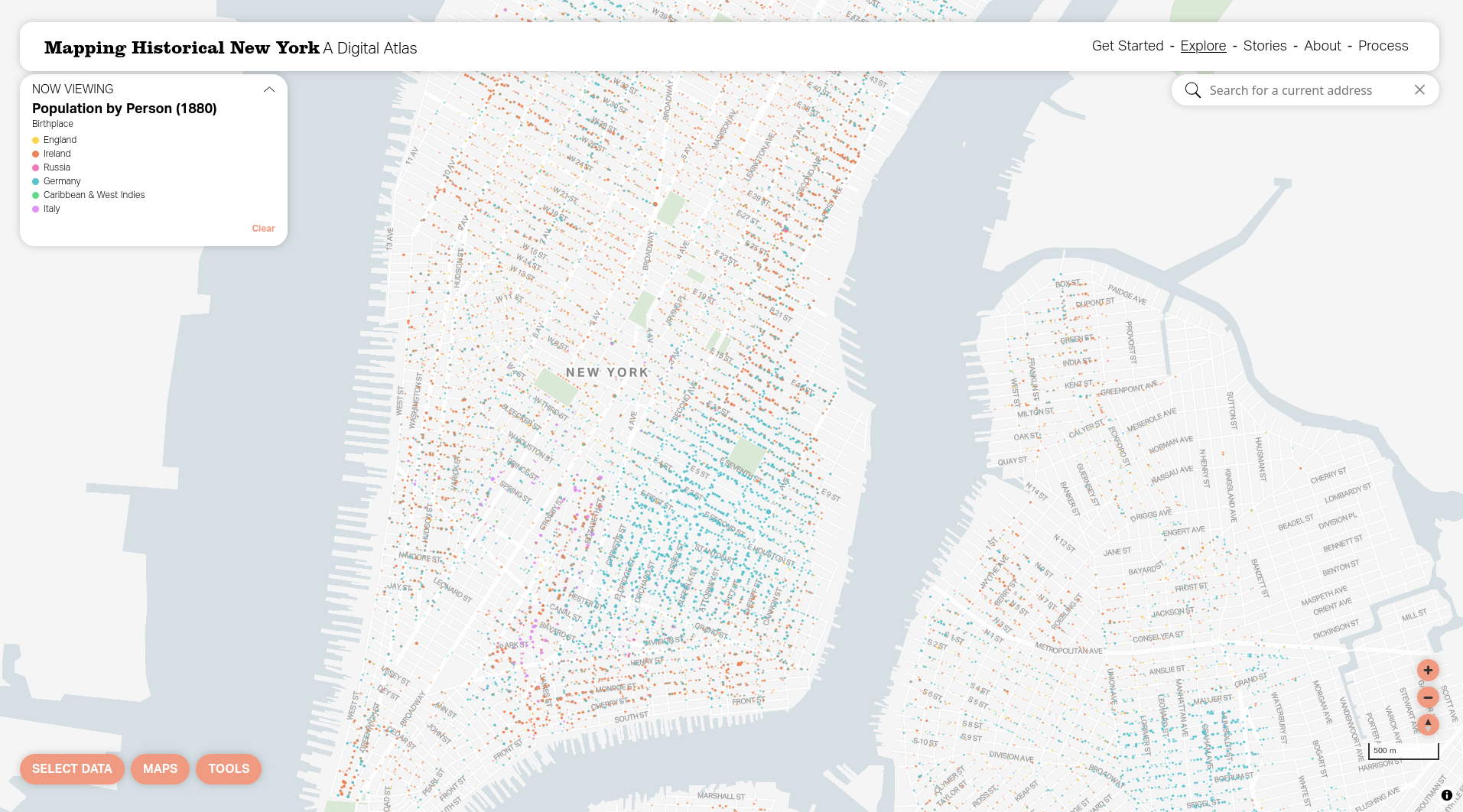
Join Columbia’s Center for Spatial Research and Stamen Design as they introduce Mapping Historical New York (mappinghny.com), a tool and data resource that provides Census data from 1850 to 1940 at the individual level. The Digital Atlas breaks new ground by locating each person counted in the Census at their home address, sometimes before the street grid was even established. This is a living project that will expand to include all five boroughs up to the 1940 census. Learn how the data were created, how to use the tool, and download the data to make your own maps.
Click "Going" to register for this event. If you are signing up for a virtual event, you will receive a Zoom link in an email confirmation.