Come join us on Thursday March 27th @ 4:00-6:30pm.

GISMO is hosting a lightning talk hybrid event to explore how NYC Open Data is being used by the NYC GIS and geospatial community, specifically GISMO members. GISMO ( NYC Geospatial Information Systems and Mapping Organization) is a professional development and networking organization, founded in 1990. We have a diverse group of speakers, both students and professionals, across NYC government agencies, universities, and public and private organizations, including NYPD, Arup, DNM Geospatial, and New York University.

The topics range from NYPD Open Data Coordinator updates, diving into DEP’s Citywide Parcel-Based Impervious Area GIS study, mapping NY Harbor water quality, citizen science data analysis in Jamaica Bay, to understanding women’s safety in walkability around NYC. Speakers will include tips and tricks to work with the data sets and for conducting research.

The lightning talks and Q&A will occur between 4:30-5:30pm. Stick around for some fun social networking with The Mappy Hour following the talks!  Light snacks and refreshments for in-person attendees.

To attend in person, RSVP here
To attend virtually, RSVP here

NYC Planning has developed the Fast Tracker app to allow users to determine whether planned housing projects are eligible for the new citywide Green Fast Track rule. The rule streamlines housing production by allowing projects of a specific typology to simplify the environmental review process, while satisfying state and city environmental standards. The app integrates ESRI Experience Builder with Survey123 and Microsoft Power Automate so users can enter project criteria and determine eligibility under the rule. We will discuss developing the app in tandem with the rule, under a strict timeline and scope. This presentation will focus on how the app was developed, how data was collected, reviewed, and processed for inclusion in the app. We will also talk about how the app and data pipelines are maintained.

This presentation is part of the Open Data @ NYC Planning event series.

Click here to RSVP for virtual attendance.

Click the blue “Going” button below to RSVP for in-person attendance at the Department of City Planning’s offices (120 Broadway, New York, NY 10271).

Queens Public Library staff will share how we use and visualize publicly available data to glean insights about the communities we serve and to inform our programs and library services.

We will provide an overview of how maps could be created using ArcGIS Online, NYC Open Data, and a NYC Planning shapefile. We will finish up by sharing free resources for further learning.

This is a session for anyone interested in making data-informed decision-making accessible to all.

Presenters: Kyeesha Wilcox, Josephine Lew, Jin Hyun Bae

OpenStreetMap is the world’s largest volunteer-driven spatial dataset, relied on by millions of people around the world. But it’s more than one big map! Need to keep track of every playground, defibrillator, storm drain, or LGBT-friendly bar in your neighborhood? OpenStreetMap lets you leverage the power of crowdsourcing to fill data gaps left by commercial and government datasets. You can manage your data all in one place for the benefit of the entire OSM community.

Join OSM expert Quincy Morgan and civic innovation specialist Jazzy Smith to learn how organizations can use OSM as a free, collaborative GIS platform to meet their geodata needs. We’ll cover OSM basics, introduce available resources and workflows, review case studies of groups leaning into OSM, and look at how the Mapping for Equity project is connecting New Yorkers to their data.

This talk is for those of all skill levels interested in open map data. Come with questions! We’ll leave plenty of time for discussion.

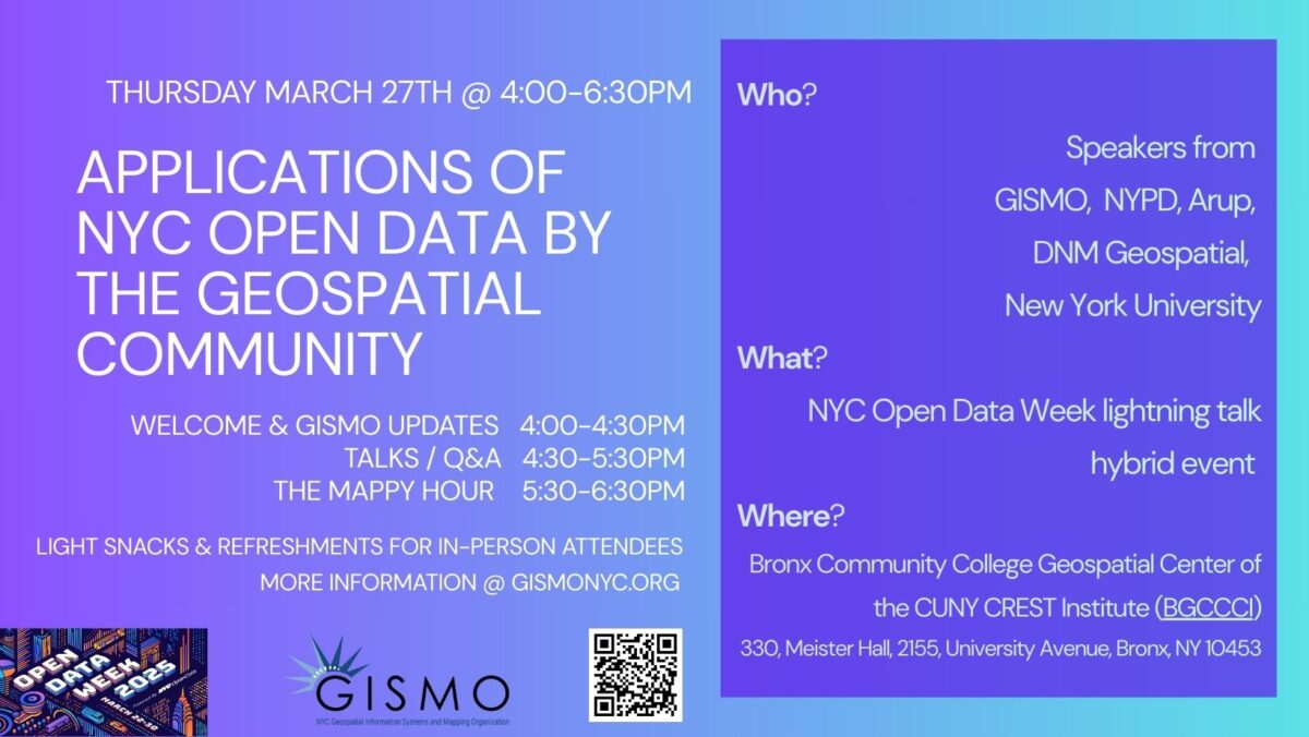
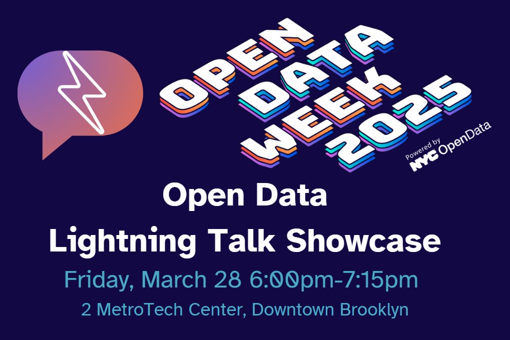
Come to the NYC Office of Technology & Innovation offices on Friday, March 28 at 6PM for a lightning talk showcase, featuring open data use cases about the human brain, the environment, web domains, trash cans, and film locations. Each of the presenters will have a few minutes to showcase their work, and this will be followed by an audience question-and-answer period.

The presentations:

Arianna Zuanazzi – Exploring Child and Adolescent Mental Health in NYC: Insights from the Healthy Brain Network Open Dataset
The Healthy Brain Network (HBN) is a large-scale open science initiative of the Child Mind Institute which releases multimodal datasets capturing a broad range of clinical psychopathology in children and adolescents based in NYC. For this event, we will briefly introduce the openly available phenotypic and neuroimaging HBN datasets and present data and visualizations that illustrate socio-economic status, neighborhood crime and safety, school risk, and mental health in NYC children and adolescents. We will then explore how the HBN dataset can be combined with datasets from NYC Open Data, such as air quality and pollution data.

Surbhi Agrawal – Using Open Data to Map Regional Resiliency Risk and Assets
Sasaki Associates has developed a data platform to empower communities in mapping and understanding regional risks from natural hazards and stressors, alongside identifying critical community assets. Using open datasets, this platform visualizes data such as expected losses to populations, infrastructure, and agriculture, enabling informed decision-making for resilience planning.

Frank Noirot – Mapping the trash can landscape in NYC with QGIS and Open Data
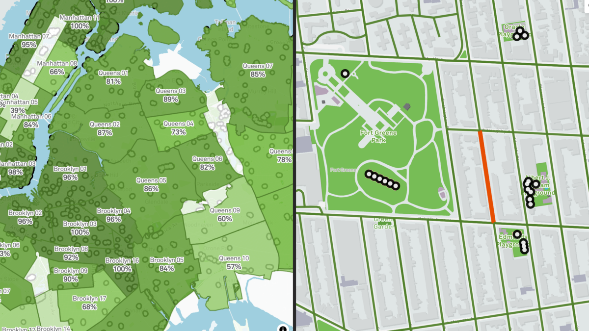
I wondered how far people had to walk to the nearest litter basket anywhere in NYC, and thanks to NYC Open Data I was able to make a map that does just that, even though I’m no data scientist! I wrote about my process in making the map. I want to encourage others who have questions about the environment they live in to take a search through NYC Open Data to see if there is a data set that fits their topic. They might be pleasantly surprised with what they find.

Bailey Kane – Enriching NYC Open Data for .nyc Websites
All .nyc domain registrations since the beginning of the program are logged in a NYC Open Data dataset. However, actual use of those registered domains is not tracked. I was curious how people are using .nyc domains, so I started AllOf.nyc to explore all registered .nyc websites by expanding upon the data offered in the NYC Open Data dataset.

Cory D. Reeves – Simulating Soundscapes: NYC Open Data for Amplified On-Site Film Location Selection
Filming in New York City presents unique challenges—permitting, logistics, and environmental sound control measures during production are some examples. Our award-winning prototype from Autodesk University 2024’s Design & Make Conference, Dynamo Day Hackathon leverages NYC Mayor’s Office of Media and Entertainment (MOME) structured film permit datasets within Autodesk Forma’s AI-powered noise analysis engine, creating real-time feasibility assessments to support film location selection. This solution enables production teams to evaluate potential filming sites more in-depth, and to-scale within dynamic, virtual 3D space before more costly on-location mobilization of film crews and production staff.

Make a night of it! Before the event, consider checking out the Data Through Design exhibition at BRIC (647 Fulton St, Brooklyn), which is a 10-15 minute walk from this event. Afterwards, join us for a happy hour a few blocks away at Sound & Fury Brewery and Kitchen (141 Lawrence St, Brooklyn).

Comparing data from different census years can be a challenge due to changes in geographies. When those data are Public Use Microdata Sample (PUMS), it may be difficult to know where to start. In this presentation, Donnise Hurley from the NYC Department of City Planning will demonstrate step-by-step how to access PUMS data using the Census API, prepare data for analysis, harmonize older data into the 2020 PUMAs (approximate NYC’s Community Districts boundaries), and make an interactive map using a few lines of code. Attendees will gain a basic understanding of PUMS data, learn how to calculate margins of error and use them to create statistically reliable map categories, and learn data wrangling techniques.  All analyses will be conducted in R statistical software, but the techniques presented are transferrable to other programs.

This presentation is part of the Open Data @ NYC Planning event series.

Click here to RSVP for virtual attendance.

Click the blue “Going” button below to RSVP for in-person attendance at the Department of City Planning’s offices (120 Broadway, New York, NY 10271).

NYC School of Data is a community conference that demystifies the policies and practices around open data, technology, and service design. This year’s conference helps conclude NYC Open Data Week and features 30+ sessions organized by NYC’s civic technology, data, and design community! Our conversations and workshops will feed your mind and inspire you to improve your neighborhood.

To attend, you need to purchase tickets. The venue is accessible, and the content is all-ages friendly! If you have accessibility questions or needs, please email us at schoolofdata@beta.nyc.

Thank you to Reinvent Albany and Esri for helping to cover conference costs and making it possible to meet in 2025.

And If you can’t join us in person, tune into the main stage live stream provided by the Internet Society New York Chapter. Follow the conversation #nycsodata on Bluesky.

Purchase your tickets here.

New York City agencies create and publish a huge volume of geospatial data each year. They use Geographic Information Systems (GIS) – computer-based tools to store, visualize, and analyze this geographic data. This panel will review publicly-available tools and datasets, discuss the state of GIS technology in the city, and consider how the City uses geospatial data to serve NYC residents.
Join this conversation with agency GIS leaders about new maps & tools, geospatial data, and initiatives for 2025.

Moderator
Lee Ilan, NYC Mayor’s Office of Environmental Remediation

Panelists
Josh Friedman, NYC Emergency Management
Matt Croswell, NYC Department of City Planning
Carmela Quintos, NYC Department of Finance
Angel Adhikari, NYC Department of Finance


Have you ever wondered how parks in your neighborhood compare with others? Meet the Vital Parks Explorer! In this session, the Innovation & Performance Management (IPM) team from NYC Parks will share some highlights of how this public-facing tool was built. The Explorer visualizes access to parks amenities and services across the city. From inception and prototype, to public release, three data professionals working in local government will give you a behind-the-scenes look at how data, analysis, visualization, and user experience considerations shaped the final product. This event is for all New Yorkers who care about parks and might be of particular interest to advocates of public spaces, civic data enthusiasts, web app developers, designers, geospatial data scientists and engineers. We look forward to your participation and feedback!

Speaker bios:
Lilian Chin is a Data Analytics Specialist on Parks’ IPM team, where she has worked since September 2023. As part of IPM, she supports a wide-range of data-driven initiatives for Parks’ Maintenance and Operations. This includes visualizing the Work Order backlog, streamlining data pipelines for park assets, developing methodologies for the Park Condition Score, building in-house dashboards, and improving data quality and documentation.

Kate Sales is a Data Analytics Specialist on Parks’ IPM team. In the last year, she has worked on projects that touch many aspects of Parks including collecting and combining volunteer data for the Let’s Green NYC initiative, creating dashboards for Vital Parks for All, and helping others learn how to visualize data. Before Parks, Kate was a GIS analyst at the urban planning consulting firm Urban3 in Asheville, NC, her hometown. She recently completed her Master of Urban Planning at CUNY Hunter College and earned her BA in geography at Macalester College.

Benno Mirabelli is a Data Scientist on Parks’ IPM team. He works on various data analysis, reporting, research, and optimization projects. Some examples of his ongoing work include the routing analysis based on LION data for the recently released Vital Parks Explorer, research on understanding usership patterns and visitor volume at parks, and new management tools that assist with grass maintenance, planning, seasonal worker assignments and more. He holds a PhD in Applied and Computational Mathematics.